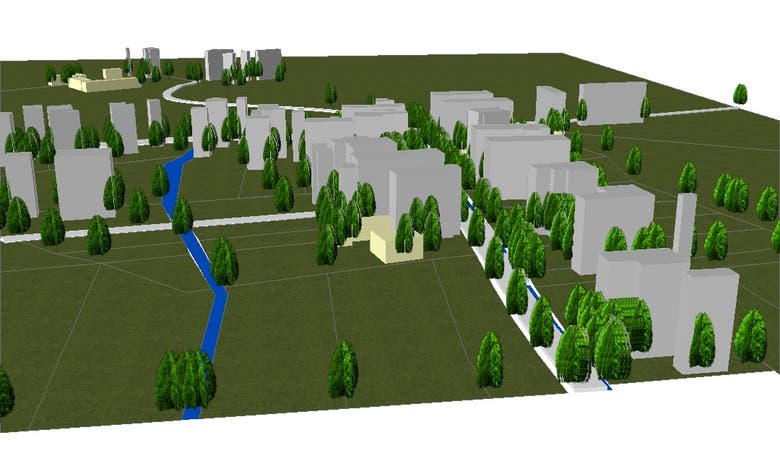
Residential Area
ESRI / ARCGIS

Hakkımda
Engineer with degree in Topography and Geomatics, passionate about cartography, terrain surveying and 3D Modeling. - ESRI - ArcGIS (digitizing, 3D modeling, spatial analysis and statistics,2D and 3D maps, geocoding) - AutoCad ( floor plans, surveying data processing, profiles and sections, 3D) - Autodesk Revit ( 2D plans, 3D plans, sections, elevation plans, modeling, rendering, layout for print) - Global Mapper - open source platforms Scientific articles The dynamic of water beds in the Black River Valley (GIS) 3D visualization for a residential area in Cluj Napoca City(GIS) Vulnerability of the Someş Mic Meadow in Terms of Hydrological and Hydrographical (GIS) Influence of Climatic Conditions on Excess Moisture at Surface and in Soil From Someş Mic Meadow (GIS) Influence on the terrain topography on the vulnerability of Someș Mic meadow (GIS) Research on the vulnerability of Someș Mic meadow in terms of hydrogeological. (GIS)